From the city of Matsumoto, the mountains of the Northern Japanese Alps dominate the western horizon. On clear days, their jagged ridgelines rise above the surrounding buildings and agricultural fields, with snow remaining on the highest peaks long after the valleys have entered spring. The difference in elevation is remarkable. Matsumoto itself stands more than 500 meters above sea level, yet the surrounding mountains reach heights exceeding 3,000 meters. Their presence is difficult to ignore, even amid the ordinary activities of urban life. The mountains influence the city’s weather, its available land, the courses of its rivers, and the routes by which people enter and leave the surrounding region. For residents, this landscape is familiar enough to become part of the background of daily life. For visitors arriving from Japan’s densely populated coastal plains, however, the scale and proximity of the mountains can be startling.
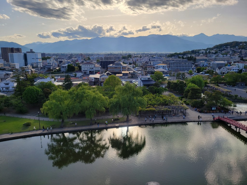
Despite their apparent permanence, these mountains are neither static nor particularly ancient in their present form. The rocks from which they are composed may be hundreds of millions of years old, but much of the dramatic topography visible today developed relatively recently in geological history. The mountains are products of the continuing deformation of the Earth’s crust, shaped by tectonic pressure, volcanic activity, erosion, and climatic change. Their development is ongoing, although the processes involved generally operate on timescales far beyond ordinary human observation. Understanding these processes offers more than an explanation for the region’s scenery. The mountains have profoundly influenced the settlement, economy, culture, and history of central Japan, creating both the opportunities and constraints within which successive generations have lived.
Nagano Prefecture occupies much of the mountainous interior of central Honshu, Japan’s largest island. Covering approximately 13,562 square kilometers, it is the country’s fourth-largest prefecture by area, yet its extensive territory contains relatively little level ground. Much of the landscape consists of forested mountains, steep valleys, elevated plateaus, and basins enclosed by surrounding highlands. These geographical features have encouraged human settlement to concentrate in particular corridors, often separated by terrain that was historically difficult to cross. Although Nagano is a modern administrative unit, established in its present general configuration during the Meiji period, the physical landscape that it encompasses has shaped human activity for thousands of years. To understand the region’s development, it is therefore necessary to begin with a history considerably older than any of its towns, temples, or political institutions.
The Mountains of Central Japan
Nagano is particularly associated with three mountain ranges collectively known as the Japanese Alps. The Hida Mountains, or Northern Alps, extend along the prefecture’s western edge and into neighboring Toyama, Gifu, and Niigata. The Kiso Mountains, commonly called the Central Alps, rise between the Kiso and Ina valleys, while the Akaishi Mountains, or Southern Alps, extend through southern Nagano and neighboring prefectures. The three ranges share certain geographical characteristics, particularly their considerable elevation and rugged terrain, but they differ in geological history, topography, and climate. They also contain some of Japan’s most recognizable mountain landscapes, including the towering peaks of the Hotaka massif, the glacial landforms of the Central Alps, and the deeply dissected valleys of the Southern Alps.
The name Japanese “Alps” reflects the influence of European mountaineering traditions during the nineteenth and early twentieth centuries. Foreign visitors like Walter Weston and Ernest Satow increasingly described the mountains of central Honshu in terms familiar from the European Alps, emphasizing their geological grandeur, challenging routes, and recreational possibilities. Although the individual ranges possessed Japanese names long before this period, their collective identification as the Japanese Alps became part of a changing cultural appreciation of mountains. Places previously understood primarily through religion, forestry, agriculture, or the practical difficulties of travel were increasingly presented as destinations for scientific exploration and mountaineering. The terminology consequently reflects not only a physical resemblance between mountain ranges, but also a particular historical moment in which Japan’s highlands were being reconsidered through new forms of knowledge and recreation.
The region’s popular description as the Roof of Japan, or Nihon no Yane, is similarly evocative, although it conceals considerable geographical complexity. The mountains do not form a single continuous elevated surface, and each range developed through a combination of geological processes. Between them lie basins, river systems, and inhabited valleys whose elevations and environments vary substantially. These lower areas are as important to understanding Nagano as the mountains themselves, since they provided the agricultural land, transportation routes, and relatively sheltered locations in which many of the region’s larger settlements developed. The history of Nagano is therefore not simply a history of life at high elevations. It is also a history of the relationships between mountains and the comparatively limited areas of accessible land that exist among them.
The Formation of the Japanese Archipelago
The geological history of Nagano begins with the formation of the Japanese archipelago, a complex process involving the movement of tectonic plates, the accumulation of geological material, and the gradual transformation of East Asia’s eastern continental margin. The Earth’s outermost rigid shell is divided into enormous sections known as lithospheric plates, which move slowly over the underlying mantle. Although these movements are typically measured in centimeters per year, their cumulative effects over millions of years are substantial. They create ocean basins, produce earthquakes and volcanoes, deform existing rocks, and raise sections of the crust into mountain ranges. Japan occupies one of the world’s most tectonically active regions, where the interactions among several major and smaller plates have produced an unusually complicated geological landscape.
The Pacific Plate descends beneath northeastern Japan, while the Philippine Sea Plate subducts beneath portions of southwestern and central Japan. The overriding crust is divided into additional tectonic regions whose boundaries and relationships remain subjects of scientific research. These processes contribute to the country’s extensive volcanic activity, frequent earthquakes, and complex geological structures. However, it would be misleading to imagine that Japan’s mountains were formed by a single collision or that the archipelago rests neatly at a point where four plates meet. The geological development of central Honshu reflects multiple episodes of deformation occurring over different periods, sometimes affecting older structures in new ways. The visible landscape is consequently the cumulative result of a long and complicated history rather than the product of one catastrophic event.
Much of the foundation of the Japanese islands formed through processes associated with the subduction of oceanic plates. Sediments, fragments of oceanic crust, and other geological materials accumulated along the continental margin, where they were compressed, folded, and incorporated into the developing island arcs. Some of these rocks were subsequently buried, heated, and altered before eventually being brought closer to the surface. During the Miocene epoch, roughly fifteen million years ago, the opening of the Sea of Japan contributed to the separation and reorganization of the developing Japanese island arcs from continental Asia. This transformation was accompanied by extensive volcanism, changes in sedimentary environments, and deformation of the crust. The broad outline of the modern archipelago gradually emerged, although its mountains, coastlines, and river systems continued to evolve.
Central Japan occupies a particularly important position within this history because it lies near the meeting area of major geological structures associated with northeastern and southwestern Honshu. One of the most significant is the Fossa Magna, a broad geological region whose name means “great trench” or “great depression.” The term was introduced by the German geologist Heinrich Edmund Naumann during the nineteenth century, when geological surveying was becoming increasingly important to scientific investigation in Japan. Naumann recognized substantial differences between the geological formations of central Japan and those farther east and west. The Fossa Magna is not an enormous open chasm, as its name might suggest, but a complicated zone containing thick accumulations of sedimentary and volcanic rocks, together with structures produced by successive episodes of tectonic activity.
The western boundary of the Fossa Magna is associated with the Itoigawa-Shizuoka Tectonic Line, a major geological boundary extending across central Honshu. Portions of this system pass through or near the eastern margins of the Northern Alps and the Matsumoto-Suwa region, separating geological formations with markedly different histories. The tectonic line is sometimes described as a dividing boundary between eastern and western Japan, although this simplified description should not be confused with a single continuous fault or a universally agreed present-day plate boundary. Its significance lies partly in the evidence it provides for the complicated assembly and subsequent deformation of central Japan. For Nagano, these geological structures help explain the unusual concentration of high mountain ranges, fault systems, and contrasting rock formations within a relatively small area.
The Rise of the Japanese Alps
Although the rocks of the Japanese Alps preserve geological events spanning hundreds of millions of years, the development of their present topography is substantially more recent. Research by the Geological Survey of Japan has associated the uplift of the Northern Alps with a period of east-west crustal compression that began approximately 3.5 million years ago. As tectonic forces shortened and deformed sections of the crust, large volumes of rock were displaced upward. The resulting uplift did not proceed uniformly across the region, nor did it immediately produce the recognizable peaks and valleys of the modern mountains. Instead, mountain building took place through the interaction of tectonic deformation and the erosion of the rising landscape, with different portions of the ranges responding according to their geological structures and physical properties.
The distinction between the age of a rock and the age of a mountain is essential. A granite formation may have crystallized deep underground millions of years before the uplift that eventually brought it to the surface, while sedimentary rocks exposed high on a summit may have originated in an ancient marine environment. The present elevation of such rocks tells us little about the environment in which they initially formed. Mountains develop as sections of the Earth’s crust are raised, but their final appearance depends equally upon processes that remove material from the surface. Rivers cut into rising terrain, weathering breaks exposed rocks apart, and gravity carries loosened material downhill. Mountain landscapes therefore reflect a changing balance between uplift and erosion, rather than a simple accumulation of rock above sea level.
In August 2026, researchers from the Japan Atomic Energy Agency, Kyoto University, and Nihon University announced findings that provided new evidence of rapid geological change in the Northern Alps. By examining granitic rocks exposed in the Kurobe region, the researchers estimated that some of the material had crystallized approximately six to nine kilometers beneath the Earth’s surface around 800,000 years ago. Its present exposure indicates that enormous quantities of overlying rock have subsequently been removed. The study suggested that uplift and erosion in the region proceeded at rates approaching one centimeter per year over that period, placing it among the world’s most rapidly changing mountain environments. This does not mean that the mountain summits have continuously increased in height by one centimeter annually, rather, it describes the exceptional pace at which deeply buried rocks have been brought toward the surface and exposed through the combined processes of crustal movement and erosion.
The researchers also examined why this portion of the Northern Alps experienced such concentrated deformation. Their models suggested that heat associated with magmatic activity may have weakened parts of the crust, allowing tectonic pressure to produce unusually rapid uplift in localized areas. The findings offer a possible explanation for the development of the Northern Alps, whose mountain-building mechanisms have historically been less straightforward to identify than those of the Central and Southern Alps, where major fault systems play a more clearly established role. More broadly, the research illustrates the importance of treating mountain formation as a dynamic and interconnected process involving pressure, heat, deformation, and the removal of rock. Even within the same mountainous region, different geological conditions may produce very different rates and patterns of change.
The mountains have also been shaped by the activity of water and ice. Once high terrain develops, it alters the movement of air and precipitation, creating conditions in which rivers and glaciers can become powerful agents of erosion. Water flowing downhill carries sediment and fragments of rock, gradually cutting channels into the landscape. Over long periods, rivers excavate deep valleys, sometimes exposing geological formations that were formerly buried. During the colder intervals of the Pleistocene epoch, glaciers occupied parts of the Japanese Alps, where accumulated snow was compressed into ice that moved slowly under its own weight. Unlike rivers, glaciers can excavate broad, bowl-shaped depressions known as cirques, as well as transport enormous quantities of rock and sediment.
The glacial landforms of the Northern and Central Alps provide particularly visible evidence of these processes. The Karasawa Cirque, beneath the Hotaka Mountains, is one of the best-known examples, its steep surrounding slopes preserving the results of glacial erosion during a colder climatic period. Similar features occur in the Central Alps, where cirques and other glacial formations remain among the most recognizable elements of the high mountain landscape. Although these features are often admired primarily for their scenic qualities, they are also records of environmental change. They demonstrate that the Japanese Alps have experienced climatic conditions substantially different from those of the present, and that the mountains’ appearance has been modified repeatedly as temperatures, precipitation, and patterns of erosion have changed.
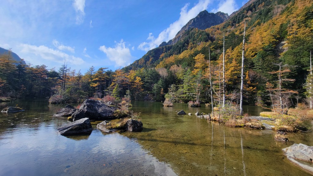
Volcanic activity has contributed another layer to this history. The Northern Alps contain several volcanic centers, and the surrounding landscape includes features produced by eruptions, volcanic deposits, and associated landslides. In 1915, an eruption of Mount Yake near Kamikochi triggered a mudflow that blocked the Azusa River, contributing to the formation of Taisho Pond. The pond subsequently became one of Kamikochi’s most photographed landscapes, celebrated for its reflections of the surrounding mountains and the remains of trees standing in the water. Its origin provides a useful reminder that landscapes commonly experienced as peaceful or picturesque may have been created by sudden and destructive geological events. The natural scenery of Nagano is not merely the inheritance of an unimaginably distant past; some of its most familiar features developed within recorded history.
Mountains, Rivers, and the Geography of Settlement
Nagano’s position in the mountainous interior of Honshu gives it an unusually important role in the country’s river systems. Although the prefecture has no coastline, water originating in its mountains travels toward both the Sea of Japan and the Pacific Ocean. The Chikuma River flows northward through the Saku, Ueda, and Nagano regions before entering Niigata Prefecture, where it is known as the Shinano River. Its tributaries, including the Sai River, drain extensive portions of central and northern Nagano. Farther south, the Tenryu River flows from Lake Suwa through the Ina Valley toward the Pacific, while the Kiso River travels through another major mountain corridor before reaching the Pacific coast. These rivers connect Nagano to distant lowland regions and have long provided water for agriculture, industry, and domestic use.
The courses of these rivers are closely related to the surrounding topography. Mountain ridges form watershed boundaries that determine the direction in which rain and snowmelt travel, while geological structures and variations in rock resistance influence the development of valleys. The resulting drainage networks have played a central role in the history of human settlement. Rivers supplied water, supported agricultural production, and created corridors through which people and goods could move. At the same time, they presented significant hazards through flooding, erosion, and the transportation of sediment from steep mountain slopes. Communities were consequently required to negotiate a complicated relationship with water, benefiting from its availability while attempting to control its destructive potential.
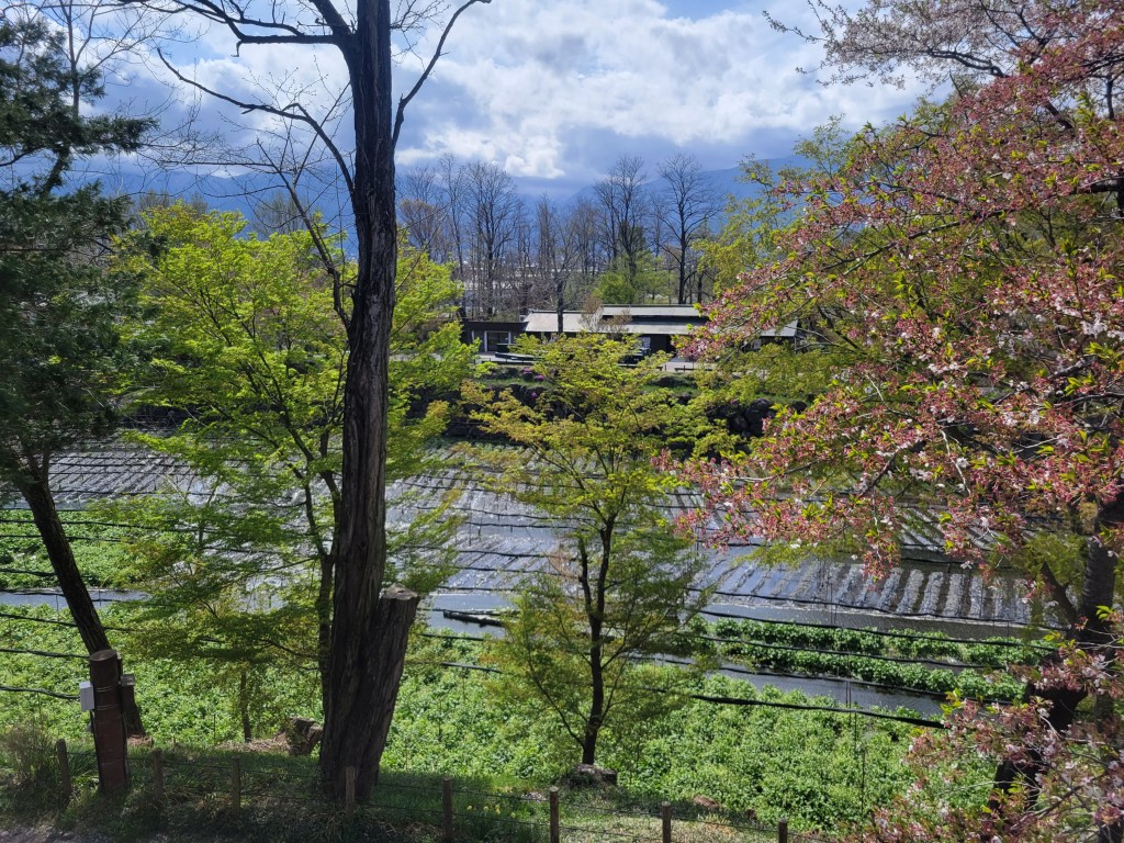
The deposition of sediment has also helped produce land suitable for agriculture and settlement. Where a river descends from steep mountain terrain onto comparatively level ground, its current may slow and deposit gravel, sand, and finer material. Over time, these deposits can develop into alluvial fans, broad sloping landforms found along the margins of many mountain basins. Such environments may offer accessible land and groundwater resources, although their drainage characteristics and exposure to flooding vary. In Azumino, north of Matsumoto, the movement of groundwater through extensive deposits of mountain-derived sediment contributes to the region’s well-known springs. These waters have helped support agricultural activities, including the cultivation of wasabi, whose growth requires suitable temperatures and a reliable supply of clean, flowing water. The crop’s association with Azumino is therefore connected to the geological and hydrological characteristics of the surrounding landscape.
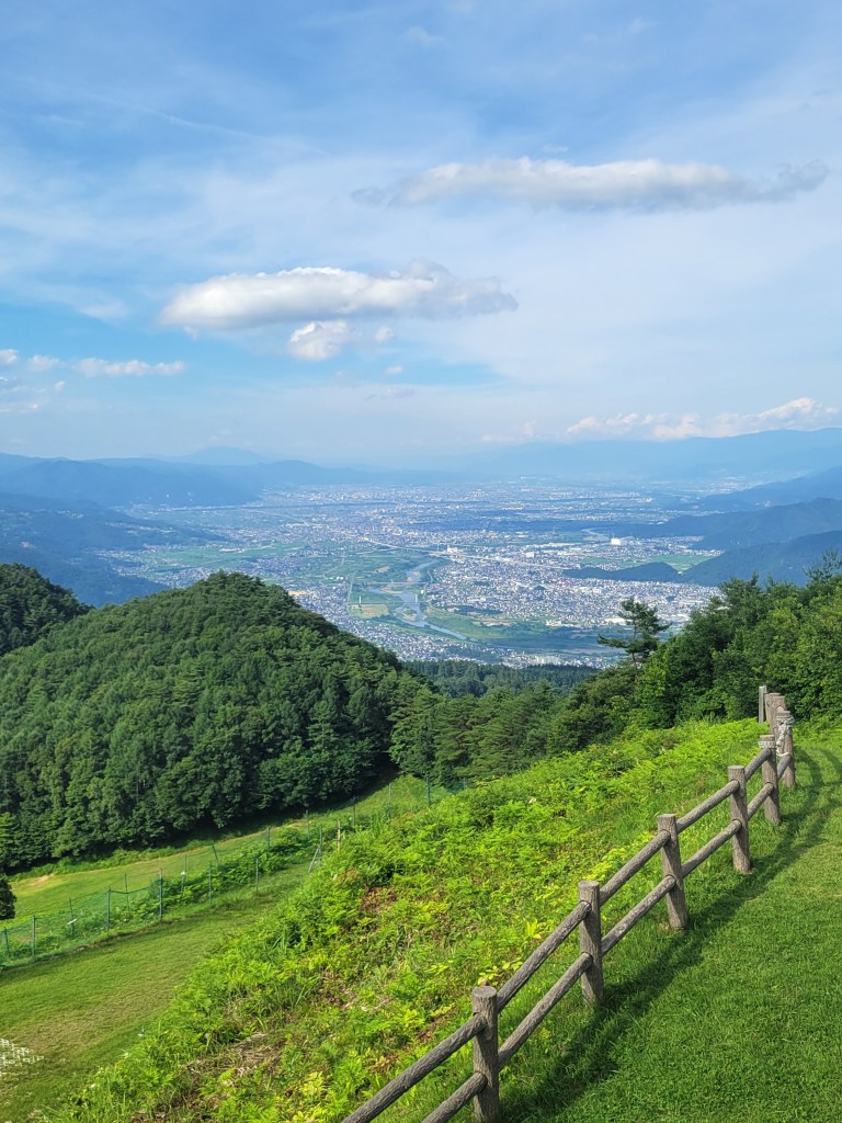
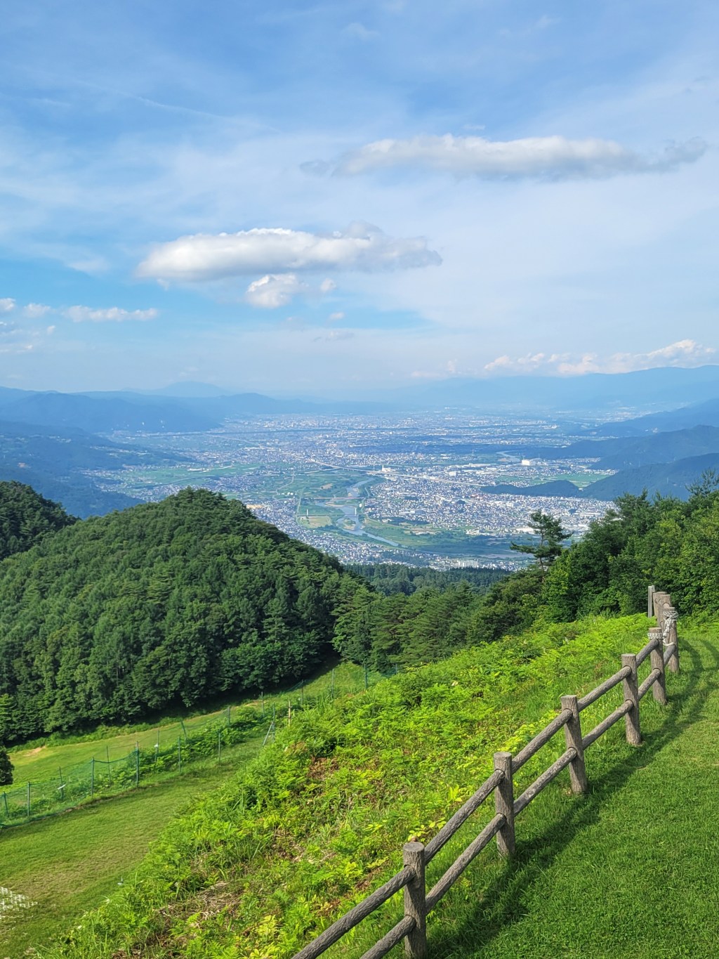
The distribution of Nagano’s towns and villages demonstrates the importance of these geographical conditions. Major settlements developed in the Nagano, Ueda, Saku, Matsumoto, Suwa, and Ina basins, where relatively level terrain and access to water created opportunities for agriculture and transportation. Other communities emerged along river terraces, mountain slopes, and narrower valleys, often adapting their activities to the limited availability of cultivable land. The contrasts between these settlement environments remain apparent today. The comparatively broad agricultural landscapes surrounding Matsumoto differ considerably from the narrow settlements of the Kiso Valley, while the high-elevation communities of eastern and southern Nagano experience environmental conditions unlike those found in the lower basins of the north.
Elevation is particularly important because it influences temperature, precipitation, and the length of the growing season. In general, temperatures decline with increasing altitude, although local weather patterns can complicate this relationship. Agricultural practices consequently differ between lower valleys and mountain communities, reflecting variations in frost risk, soil conditions, water availability, and the amount of land that can be cultivated. Rice cultivation became important wherever appropriate fields and irrigation systems could be established, while upland agriculture also depended upon crops suited to comparatively cool conditions or shorter growing seasons. Buckwheat, one of the foods most closely associated with Shinshu, became particularly important in some of these environments. Its prominence in regional cuisine reflects a combination of agricultural suitability, historical practices, and cultural preferences rather than a simple inability to produce other grains.
The restrictions imposed by mountainous geography should not be overstated, however. People have repeatedly modified landscapes through terracing, irrigation, forest management, road construction, and the development of agricultural technologies. Communities occupying difficult environments were not simply passive recipients of geographical conditions; they actively transformed their surroundings to meet practical needs. Nevertheless, the relative scarcity of level land has remained a defining feature of the prefecture. Nagano’s present settlement patterns reflect a long history in which available space, reliable water, transportation routes, and environmental hazards all influenced decisions about where and how people could live.
A Prefecture of Contrasting Climates
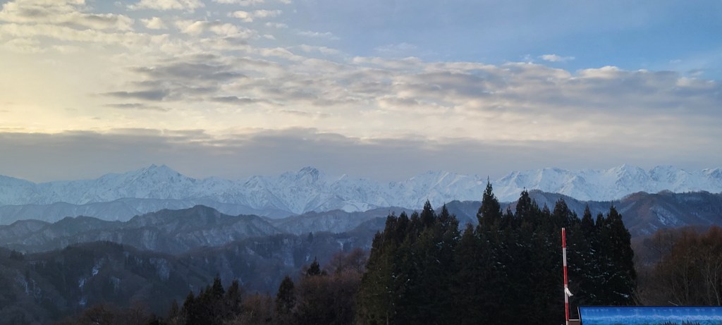
The mountains also divide Nagano into climatic regions whose differences can be remarkable over comparatively short distances. Northern Nagano receives substantial winter snowfall because cold seasonal winds cross the Sea of Japan, collect moisture, and rise over mountain terrain. As the air cools, moisture falls as precipitation, producing the heavy snow associated with communities such as Hakuba, Otari, and Nozawa Onsen. In contrast, parts of the prefecture’s interior experience much drier winters after approaching air masses have lost much of their moisture while crossing the surrounding mountains. This phenomenon, associated with the orographic effects of mountainous terrain, helps explain why some Nagano communities experience deep winter snow while others are characterized by cold, comparatively sunny weather.
The enclosed basins of central and eastern Nagano also experience pronounced variations between daytime and nighttime temperatures. Under clear skies, heat can escape rapidly from the ground after sunset, while cold air descending from surrounding slopes may accumulate in low-lying areas. These conditions can produce particularly cold winter mornings and substantial temperature differences within relatively small geographical areas. Local variations in elevation, slope orientation, and exposure to sunlight further influence agricultural conditions and the seasonal rhythms of everyday life. A community situated on a south-facing slope may experience a different pattern of snowmelt and solar exposure from a settlement at the bottom of a nearby valley, even when both are located within the same municipality.
Over time, these climatic distinctions have contributed to differences in architecture, agriculture, food preservation, and community practices. Heavy-snow regions require buildings and infrastructure capable of withstanding significant winter precipitation, while the need to clear and manage snow affects transportation and household labor. In areas with drier climates, the availability and management of irrigation water may assume greater importance. Seasonal foods and preservation techniques also reflect the practical requirements of particular environments, although cultural traditions are influenced by many additional factors. Nagano’s reputation for winter weather therefore conceals considerable regional variation, much as the general image of a mountainous prefecture obscures the differences between its individual valleys and basins.
These geographical and climatic divisions help explain why Nagano has never been culturally uniform. Communities separated by mountains could maintain distinct patterns of trade, agriculture, religious practice, and communication, particularly during periods when crossing the highlands required considerable time and effort. Different valleys developed relationships with neighboring regions beyond Nagano’s present borders, while some mountain passes facilitated connections that might otherwise appear geographically unlikely. The contemporary prefecture encompasses these varied historical landscapes within a single administrative framework, but their distinct identities remain important to understanding regional culture. The mountains divided communities, yet they also created the conditions through which different forms of local knowledge and practice developed.
The Roads Through the Mountains
Although Nagano’s mountains created barriers to movement, they also helped determine the routes through which people traveled across central Japan. Roads generally followed river valleys, relatively gentle slopes, and accessible mountain passes, concentrating commerce and communication within particular corridors. During the Edo period, the Nakasendo provided an important inland route between Edo and Kyoto, passing through the Kiso Valley and supporting a network of post towns. Settlements such as Narai and Tsumago developed in connection with the movement of officials, merchants, pilgrims, and other travelers, providing accommodation, transport services, and supplies. Their historical importance cannot be separated from their geographical positions, which made them useful stopping points along one of Japan’s principal highways.
Other routes connected Nagano’s interior communities with coastal regions and neighboring provinces. The historical Chikuni Kaido, often associated with the Salt Road, linked the Sea of Japan coast around Itoigawa with settlements farther south. Salt was particularly important to inland communities because it was necessary for food preparation and preservation, while its distribution depended upon broader systems of trade and transportation. Portions of the route followed geographical corridors associated with the region’s complex geological structures. Although the relationship between a particular road and the underlying geology is rarely simple, these routes illustrate how natural landforms helped shape commercial networks. The mountains did not isolate Nagano completely; instead, they made certain connections especially important.
The economic significance of these routes changed with the development of modern transportation. Railways, tunnels, improved roads, and eventually expressways and high-speed rail reduced some of the difficulties that had historically restricted movement through the mountains. Nevertheless, constructing and maintaining infrastructure in such terrain remains demanding. Roads must accommodate steep slopes, unstable ground, snow, and the possibility of landslides, while tunnels and bridges require substantial engineering investment. Modern transportation has altered the relationships between communities, but it has not removed the underlying geographical constraints. The landscape continues to shape both the opportunities and costs of regional development.
Living with an Unstable Landscape
The geological forces responsible for Nagano’s mountain scenery have also produced significant natural hazards. Active faults, steep slopes, unstable geological formations, and rivers capable of transporting enormous quantities of sediment create conditions in which earthquakes, landslides, and floods can have devastating consequences. These processes are related, and a single event may trigger several forms of disaster. An earthquake can destabilize hillsides, a landslide can obstruct a river, and the subsequent failure of the resulting natural dam can produce destructive flooding far downstream. The interconnected character of these hazards is an important feature of mountainous environments, where events originating in one location may have consequences for communities at considerable distances.
One of Nagano’s most destructive historical disasters occurred on May 8, 1847, when an earthquake estimated at magnitude 7.4 struck the region around Zenko-ji in present-day Nagano City. The earthquake occurred during a period of religious pilgrimage, when the temple and surrounding settlements were receiving large numbers of visitors. Buildings collapsed, fires spread, and extensive landslides occurred in the surrounding mountains. One particularly significant landslide blocked the Sai River, creating a temporary natural dam. Water accumulated upstream until the obstruction failed several weeks later, sending a destructive flood through downstream communities. Historical investigations conducted by Japan’s Cabinet Office estimate that the earthquake and its associated disasters caused approximately ten thousand deaths, although precise figures remain uncertain.
The Zenko-ji earthquake demonstrates that the consequences of mountain-building processes extend far beyond their role in producing dramatic scenery. The same geological structures that shape basins and mountain slopes can generate earthquakes, while the steep terrain created through uplift makes landslides a persistent concern. At the same time, the disaster reveals something about the relationship between environmental danger and human society. Contemporary records document not only destruction, but also relief efforts, the circulation of information, religious responses, and assistance between communities. Disasters are physical events, yet their consequences depend upon settlement patterns, infrastructure, social relationships, and the capacity of people to respond collectively.
Modern engineering and scientific research have greatly improved the ability to understand and manage these risks. Geological surveys identify active faults and unstable slopes, meteorological observations help forecast hazardous weather, and local governments maintain systems for evacuation and disaster preparedness. Yet such measures cannot eliminate the processes that created the landscape. Earthquakes remain possible, rivers continue to transport sediment, and mountain slopes are continually altered by weathering and erosion. The apparent stability of Nagano’s mountains is therefore best understood as a matter of human perspective. Geological change may proceed slowly enough to escape daily notice, but the landscape remains active.
The Mountains and Human History
For much of Nagano’s history, mountains were understood primarily through the practical and cultural relationships people maintained with them. They supplied timber, water, stone, food, and grazing land, but also restricted travel and presented considerable danger. Many mountains possessed religious significance, and particular peaks became associated with deities, pilgrimage traditions, and practices of ascetic worship. Forests could function simultaneously as economic resources and sacred landscapes, while particular mountain passes held importance for trade, communication, and military movement. Such relationships were rarely limited to a single purpose. A mountain could be economically valuable, spiritually significant, and physically threatening to the same community.
The modern development of tourism and recreation introduced additional ways of experiencing these landscapes. Mountaineering, skiing, scientific exploration, national park designation, and the growth of resort communities transformed parts of the Japanese Alps into destinations for visitors from across Japan and overseas. Mountains increasingly appeared in advertisements and cultural representations as symbols of natural beauty, health, adventure, and escape from urban life. These newer interpretations did not replace earlier relationships entirely, but they altered the economic and symbolic significance of particular places. A landscape once valued for forestry, agriculture, or religious practice could become a major tourist destination, generating new forms of employment while also creating pressures on infrastructure, housing, and the environment.
Today, Nagano faces questions that demonstrate the continuing significance of its geography. Rural depopulation and population aging can make it increasingly difficult to maintain roads, agricultural fields, irrigation systems, and communal forests. Climate change is altering patterns of snowfall, precipitation, and temperature, with consequences for agriculture, mountain ecosystems, and winter tourism. At the same time, improvements in transportation and communication allow some communities to develop new economic activities and attract residents seeking alternatives to life in larger cities. These transformations are shaped by political, economic, and social decisions as well as by geography. The mountains establish important conditions, but they do not determine a single inevitable future.
The distinction is worth emphasizing because accounts of mountainous regions sometimes present geography as an explanation for everything that follows. Nagano’s difficult terrain certainly influenced where people settled, what crops they cultivated, how they traveled, and which communities developed close relationships. However, human beings have continually responded to these conditions through innovation, cooperation, competition, and cultural change. Irrigation made agriculture possible in difficult places, roads connected communities across mountain passes, and new technologies transformed economic possibilities. The landscape constrained human activity, but it also offered resources and opportunities whose importance varied from one historical period to another.
From Matsumoto, the Northern Alps still appear much as they might have to observers centuries ago, although both the city and the mountains have changed in ways that may not be immediately visible. Their rocks preserve evidence of ancient oceans, volcanic activity, tectonic deformation, and the erosion of geological formations once buried deep underground. The rivers descending from their slopes have transported sediment into basins, supplied water for agriculture, and shaped the routes through which people traveled. The mountains have influenced regional climates, encouraged differences between neighboring communities, and created the physical conditions within which much of Nagano’s history unfolded.
Understanding this landscape requires us to consider two vastly different timescales at once. Geological processes operate over thousands or millions of years, while human societies transform within generations. Yet the two histories remain closely connected. The valley that provides a location for a town, the mountain pass followed by an ancient highway, and the spring that supplies water to a field all belong to a physical landscape whose development began long before human settlement. Nagano’s mountains are therefore more than an impressive natural setting for the region’s history. They are an essential part of that history, continually influencing the relationships between people, resources, communities, and the wider world.
The Roof of Japan is not a finished structure inherited unchanged from the distant past. It remains an active landscape, subject to the same geological forces that produced it and to the increasingly significant influence of human activity. Its mountains offer a framework for understanding how geography and history interact, not as separate fields of inquiry, but as different approaches to a shared environment. To understand Nagano’s people and cultures, we must first recognize the land upon which their lives have unfolded, and the extraordinary processes that continue to shape it.



Leave a Reply